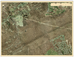
This is vector digital color aerial photo set of the park. The scale is 10,000 by 10,000 feet per tile, and this map uses partial data from four tiles. Data originated from the PAMAP Program, Bureau of Topographic and Geologic Survey, PA Department of Conservation and Natural Resources. View Full Size
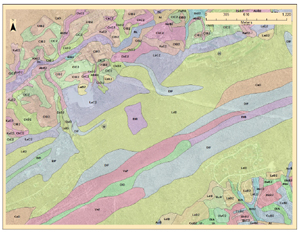
This version demonstrates soil composition
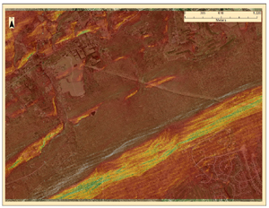
In this version I added a Hillshade layer to illustrate a 3D
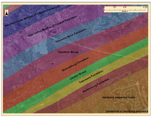
This is a map representing the geological formations underlying the park.