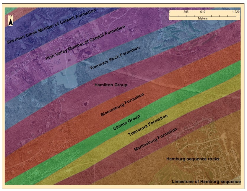
Below are examples of small scale maps of a state park. The aerial photos used as a base map are from the PAMAPS from data on the PASDA website. The aerial resolution is 3.2 feet per pixel, and 10,000 x 10,000 foot square tiles.
Make a free website with Yola